Basil Jones Central

AMBERGRIS CAYE AND AREA MAPS   


 Basil Jones Central  
 Table of Contents - check out all our pages!  
 Information about Basil Jones, North Ambergris Caye and Belize  
 North End Property For Sale  
 Basil Jones, Ambergris Caye, and Belize History  
 The Basil Jones Maya Site  
 All about planting Coconut Trees  
  Maps of Basil Jones, Ambergris Caye and Belize 
 Basil Jones Neighborhood Association Main Page  


An Eclectic Mix of Maps from
Ambergris Caye


Area Maps


  Basil Jones Maps
  Ambergris Caye Maps
  Hurricane Keith
  

Tree growing at Lamanai.  
Click to enlarge, click BACK to return.


Basil Jones
Basil Jones Beach
Basil Jones Beach (now defunct)

Plot map from the Nella Reid Subdivision.


Rough map to Bercellon Maya Site


Ambergris Caye
Dr. Mazzullo's map
dive sites in the area
(off site)
     

Dr. Mazzullo's map
localities/ geographical
areas of Ambergris Caye
(off site)
     

The Mazzullo Map of Ambergris Caye
(off site)
Possible trade routes from Bercellon on North Ambergris Caye.
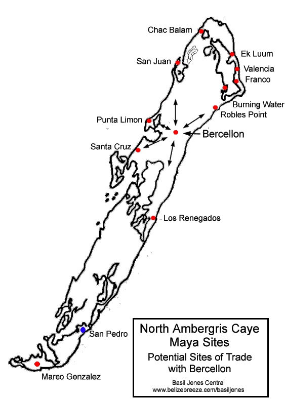
Possible routes from Bercellon.
     
Dr. Mazzullo's
map of Maya sites in Belize (off site)
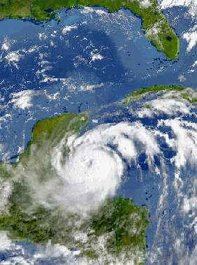
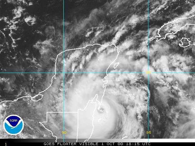


Hurricane Keith
October 1, 2000 found Hurricane Keith sitting right on top of Ambergris Caye. Keith ended up becoming a Category 4 Hurricane with gusts up to 155MPH and sustained winds over 125MPH. The slow moving Keith stayed at force for over twelve hours, never moving more than a half a mile in any direction. Here are some images of Keith.


Hurricane Keith October 1, 2000 

Hurricane Keith NOAA
Map-Vapor
     
Hurricane Keith
NOAA Map-Color
     
Hurricane Keith
NOAA Map-Track


Animated NOAA Hurricane Keith Map, click to animate.
NOAA's animated Hurricane Keith (image at max size).
Belize is visible at the bottom. Click to animate.


Basil Jones Central and its contents are Copyright © 2000 - 2019 by BelizeBreeze.com
All rights reserved